 |
 |
March
12, 2005: Heads in the clouds |
||||||||||||
Today's entry is by Romulus and focuses on a group ride that was a central focus of CrankenFine's bachelor party weekend. Ever take a nice weekend getaway to a really cool place, like say Yosemite? And on the way home somebody gives you a fender-bender, thus leaving you with a sour taste and the hassles to come -- our 40+ mile biking journey last week felt much the same way.
Starting from the Fairfax theatre just off Broadway, the sun looked ready to embrace us, just as it had the previous four days throughout the Bay. But a wall of foreboding grey clouds framed the hilltops as we headed towards the coast. I put on some new IRC Serac tires the night before without really adjusting the brakes so we weren't even a half mile into it before I had to stop for a 10-minute mechanical repair -- these things happen when you’re too hyped for a ride. Once that was complete the piercing pain from neglecting nature haunted us both; sadly, civilized society seldom provides convenience for those in search of diuretic relief. We endured the pain as long as possible until we reached a secluded enough roadside area to desecrate the land with bodily emissions. Phew! Despite the anxious discomforts, few things compare to the euphoria of a good long hot piss when the bladder is under such duress. Iron Springs Rd. usually has bike or car traffic to keep you alert but since it was only 8 AM, nobody witnessed our hillbilly hygiene tactics. We decided to remove a layer of clothing before entering Camp Tamarancho as the weather was still very promising. We headed up the Alchemist trail, the initial 1/2 mile stretch of single-track that leads to the main loop. Considering the crazy amount of rainfall in the month since my last ride here, I immediately noticed the relatively dry conditions of the track. And considering the canopy that envelopes most of the Camp, it was a gentle surprise to have so little moisture. Camp T is 80% smooth singletrack with rocks and/or tree roots dominating the technical sections. Since we went counter-clockwise on the Goldman trail, our route did not include the rougher sections of the Serpentine and Wagon Wheel trails. Instead we rode the dense wooded section of the Goldman and linked to the Broken Dam. The Broken Dam trail is the highlight of traveling counter-clockwise (along with the Serpentine if you do a full loop) because of the rapid descents and changing terrains. I was taking aggressive lines as the new tires were inspiring great confidence, and Cannonball was rippin' through the forest like a Jedi warrior on a lightcycle. We exited the Camp at the B17 junction and made the grueling climb towards San Geronimo Ridge Rd. It is notoriously difficult to locate this section on a map so local knowledge certainly helps, but I was surely doing some navigational guesswork once we left the camp. Basically, a cascade of rolling, rocky, steep fireroad meanders to a junction called White Hill Rd. You can connect with White Hill via the B17/Wagon Wheel interchange in Tamarancho, but we decided to go around that herculean climb since we had so many unknown miles still to go. There are just enough connector roads to confuse and distract but my homework seemed to be paying off. There is a junction where the road Y's in opposite directions -- this is the White Hill/San Geronimo interchange. If not for the sprinkling of greenery and the brown Mt Tam watershed signs, the terrain resembles a lunar landscape, dry lakebed combo stuck between deep green hillsides. Three bikers were climbing up opposite the direction we were headed and they would be the last people we'd see for the next hour. Our climb brought us to about 1500 ft elevation. If we had gone left at the interchange we could have climbed the fabled Pine Mountain and descended down into the Kent Lake area but we had a rendezvous at Samuel P. Taylor State Park at 10:30 and I was still not 100% confident in the route. Our final leg of the journey was also in the southeast direction – the famed Repack FR - so we stayed the course going west and found ourselves headed gradually downhill through some very rutted and rocky track. Cannonball on the full-suspension was much swifter during this section while my hardtail got abused. After about 4 km of descending we came upon another junction (where the Kent Lake/Pine Mtn loop links back to San Geronimo Ridge) before embarking on a super steep 5 km climb overlooking Kent Lake. The maps show this spot as Green Hill, about 1400 ft in elevation. The traction was so good and our rhythm so strong that we annihilated the climb and took photos to illustrate our glory. The next couple of miles were mostly downhill with a few brief humps and some wicked water breaks to conquer but we managed to rip through it with no alarms. The terrain was looking very familiar to me as I'd done some hiking in SP Taylor in 2004. We stumbled upon a sliver of single-track that was unmarked, which for mountain bikers is like giving a basehead a month vacation at Tony Montana's villa. We indulged ourselves to the fullest and the detour was surprisingly technical, with equal parts exhilaration and utter contempt. First, my rear brakes accumulated some debris that forced me to dismount and readjust. It was evident that the wheel got slightly misaligned plus the debris lodged itself between the pad and rim, causing an annoying squeak. Secondly, Cannonball had the notorious chain suck ailment creep up near the end of the single track. CJ cursed and cajoled his machinery for about 15 minutes before finally exiting the single-track in disgust. Upon realizing that the mystery single-track took us right back to the original fireroad, we both silently pondered the wisdom of the detour. To hell with hindsight -- it was time for another safety meeting as our clocks read 10:15 AM.
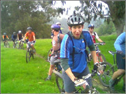
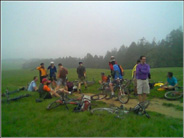
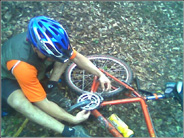
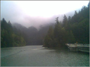
At this point there was some concern about making our rendezvous but we were confident that our links would be running behind since the group was dominated by habitually late movers. The target time was 10:30 so the odds were not in our favor. Fortunately, leaving the safety meeting we were surprised to be greeted with the smoothest, fastest, 1.5+ mile descent you could ever imagine. Before we knew it we were crossing the bridge that marks the entrance to SP Taylor -- Hooray! The mileage read 17.5 and with the mechanical issues it probably took 40 minutes longer than necessary. Granted, I can't name off the trails with complete accuracy, but I'm proud to say that we made the trek from Camp T to SP Taylor with no wrong turns, or at least the kind where you parade downhill in delight and struggle back up in disgust. We rambled along Sir Francis Drake until we reached the main camp/picnic area. Too silly to ask the ranger where to locate our crew we circled about the place in vain and wasted 15 more minutes before going back to ask the ranger what we should've in the first place. The vibe from the ranger was not friendly and I just assumed he was closet Klan but he did point us in the right direction. Of course filtering his unfriendliness made the details fuzzy so we inevitably had to ask another park worker where to go. Amazingly, we ran right into our crew just as they were hitting the trails. Outside of a race, I've never been in a pack of 19 riders and it was a wonderful sight to see. Since the plan for Cannonball and Romulus was the entire Bolinas ridge, we immediately let our intentions be known to the group’s honoree. It was not a second after that discussion when the peloton had it’s first mishap. A group of three riders rode past the Jewell TR entrance and continued well ahead of the pack. After about five minutes all except a few riders continued on while I decided to chase down the missing -- within a quarter mile a pair returned and the third joined up about five minutes later. Finally, the second leg of the journey was about to begin, or so I thought. The Jewell trailhead was a soggy muddy mess that made the grade steeper than it appeared and it certainly didn't help that I was in the wrong gear. As I attempted to downshift the gruesome sound (think fork clattering in kitchen sink disposal) of my drive-train woes forced me to dismount the bike and walk a small portion of the climb. Up until then I’d navigated most of the ride using three gears on my middle ring and three on the granny, all because the chain and rear cassette were badly worn. I felt plenty strong physically but this mechanical problem was surely a bad omen. The next five miles of the peloton covered Jewell and Bolinas and can best be described as fraternal. Bolinas is like a voluptuous woman with a split personality. The section north of the Shafter Bridge TR is an endless cow pasture replete with mud, dung, soggy grass, occasional rocks, and scattered cow herds who find humans annoying; and even if it’s not wet, a rear fender is highly recommended to keep the putrid soil from flying on you or the poor lad behind. The southern section is a densely wooded forest sprinkled with redwoods and oozing a crisp, steady mist. The common denominator is the relentless rolling hills terrain; it always seems you’re either going up or down, seldom an extended run of flat track. One thing seems certain, the route we took certainly had the steepest climbs in the northern section. However, Cannonball and I could not take advantage of this because of the peloton. In fact, the reason for the peloton’s very existence was to celebrate Dr. CrankenFine's bachelor party, so allow me to digress. Nineteen bike riders certainly don’t come together by accident, but there was a lot of luck getting the final two riders linked up with the other seventeen. Several guys camped the previous night at Samuel P. Taylor while others arrived Saturday morning for breakfast at the campsite. Cannonball and I were both invited to the camping excursion, but we decided to opt for the bike ride only. With the racing season six weeks away and several training days already washed away with winter’s weeping waves of wet weather (alliteration intended), we viewed this day as an opportunity for an epic training ride. Thus, the two of us committed to this three-part drama and part two was highlighted by a very indulgent safety meeting with seventeen comrades. Once the Shafter Bridge TR came upon us, we bid the seventeen farewell and entered the forest. The first mile was fairly benign but the forest got darker and denser as we passed the Randall TR on our right, where prominent signs gave me reassurances that we’d navigated flawlessly. And right on queue another short rise was ready for attack. The assault was successful, but the price nearly too costly to bear. I was in the wrong gear (again) at the base of the grade so I decided to shift up to avoid losing momentum. The grinding mess came to a sudden conclusion right at the top as the chain finally snapped. What ensued was a clumsy rendition of a bad comedy skit. All of the tools were at our disposal, but our wits mimicked the cold grey clouds that shrouded the forest. The first mistake was not being experienced with a chain tool. Is that something you practice at home on a rainy day? If you don’t have a garage and tools to do regular home maintenance, most folks don’t put chains on themselves. I liken the experience to carrying snow chains for your car -- it’s one thing to put them on, but it’s another thing to install them during a frigid snowfall at the side of the highway. Same goes for fixing a broken chain in the middle of a damp forest and 28 miles into a ride. To exacerbate the situation, the chain was mangled beyond recognition and I must admit that I’d knowingly stretched it (pun not intended) past its limits. Anyhow, I used the tool incorrectly by pushing the pin too far out of the link and watching it fall to the forest floor. The next mistake was opening the “smart link” that is standard on all SRAM chains. I did this in hopes of making the chain easier to work with. Of course, the trial by error chain-tool utilization inevitably led to the chain be broken in two parts now, only we didn't’t know it then. I had the wisdom to always keep some extra links in my camelback and we certainly needed them. The struggle got worse as the chill started to set in on us and the fingers numbed. We couldn't’t seem to gather all the pieces for a male/female connection and once we finally did, the smart-link became the problem – we got it back on but not without a fight. After at least 30+ minutes of this bungling nonsense we were back on the trail for a brief moment. The links we added were more than what we took out so the chain was now too long. Curiously, the smart-link broke this time around. We fixed this fairly quickly, but we made the mistake of threading it through the derallier wrong. To fix this took another ten minutes because I pushed the pin out too far again. Finally, the chain was repaired and we were on our way having wasted a good hour being silly. Somehow the chain seemed to be working better than before the breakage, but I wasn't willing to chance it. We came upon the McCurdy TR junction where the sign read 3.4 miles to the end of Bolinas Ridge. Whatever faith I had in the chain repair would be severely tested over those remaining miles on the ridge. To be safe, I found a middle ring gear and stayed in it throughout – a painful but necessary endeavor. The blissful joy of reaching the trail end was heavily muted by the anxiety over the 12 miles still to go and the scary thought of the chain not holding out. We headed east on Fairfax-Bolinas road and enjoyed the rapid twisty descent to the the Alpine Lake area, passing several roadies and photo-seeking motorists. Lingering cloud cover draped shadows over the hills and lakes but the tranquility and beauty was rejuvenating. As we slowly climbed out the physical stress of the ride finally started to creep in. Seeing the road wind up through the picturesque hills was actually discouraging at first, but the climb itself was gradual and not terribly taxing, as evidenced by my being in the middle ring the entire ascent. Once we reached the summit I took note of the Old Vee Rd junction, which was our original destination and link back to Pine Mtn and Repack. One day I will assault that section, but on this day we enjoyed the long downhill through some of Marin’s most divine real estate. Before we knew it we were back at the Fairfax Theatre, battered, humbled, relieved, and hungry. Nonetheless, several things made this ride an eye-opening experience. First of all, it reinforced my belief in doing your homework as it relates to navigation. The more maps the better, but the key for me is visualizing trails, connectors, landmarks and whatever else I can file to memory. Secondly, expert navigation is a prerequisite for any large group ride. It is my experience that relying on one person to lead the journey is the best thing, unless this person is proven incapable or incompetent. This is especially true for riders who are unfamiliar with each other, the terrain, or both. When there is no hierarchy of leadership the ride will inevitably deteriorate into constant stops where the direction is debated, the mileage gets depleted but the bike time seems endless. Thirdly, the biking gods don’t look kindly on fools who ignore the signs of wear and tear. I've never broken a chain before but this one was ripe for the plucking. In fact, I was pushing for another week of riding because I wanted to get the major tune-up as close as possible to the races next month. Despite my Sigma computer telling me maintenance was almost two hundred miles past due and the shifting resembling ice in a blender, I rolled the dice and lost. Lastly, there is nothing more invaluable than a dependable wheel-mate. Cannonball possesses the fortitude, patience, and skills to make even the 10 mile spinner around the city an enjoyable and worthwhile experience. No doubt we will conquer this journey again sometime in the future.
|
| Mileage: 41.63 | Time: 4:34:20 | Avg: 9.1 | Max: 31.5 | Weight: 170 |
Got
a comment or question? Send it to truthmaker24@yahoo.com. |
||
-- Amalgamated TruthMaker Enterprises --
